
Jefferson County ZIP Code Coverage at a Glance
The official LOJIC ZIP polygon layer returned 41 distinct values on August 25, 2026. One value can occupy more than one polygon because postal shapes may be noncontiguous. The area names below come from the LOJIC map, not from city-limit claims. Exact post office or delivery-city handling should be checked through USPS for the particular address.
| ZIP Code | Areas Covered | Post Office | Notes |
|---|---|---|---|
| 40023 | Eastwood, eastern county | Verify with USPS | Not a city-limit proxy |
| 40025 | Glenview, northeastern county | Verify with USPS | Near the county edge |
| 40041, 40047, 40067 | North, east, and rural county pockets | Verify each address | Postal and local labels may differ |
| 40059 | Prospect area | Verify with USPS | May cross a municipal edge |
| 40109, 40118, 40177 | Southwest county, Fairdale, Valley Station | Verify each address | County pockets outside the 402xx cluster |
| 40202, 40203, 40204 | Downtown, west-central, Baxter | Louisville delivery area; verify station | Urban core ZIPs do not define neighborhoods |
| 40205, 40206, 40207 | Highlands, Hikes Point, Baxter, Masonic Home, St. Matthews | Louisville delivery area; verify station | Neighborhood and municipal lines differ |
| 40208, 40209, 40210, 40211, 40212 | West and central Louisville, Camp Taylor, Standiford | Louisville delivery area; verify station | Use LOJIC for local area context |
| 40213, 40214, 40215, 40216, 40217 | Buechel, Camp Taylor, Beechmont, Iroquois, Shively | Louisville delivery area; verify station | Separate tax and postal geography |
| 40218, 40219, 40220 | Buechel, Okolona, Hikes Point, Plainview | Louisville delivery area; verify station | Area labels cross ZIP edges |
| 40222, 40223, 40225 | Lyndon, Anchorage, northeast and eastern county | Verify with USPS | Home-rule city context matters |
| 40228, 40229 | Fern Creek, Highview, south county | Louisville delivery area; verify station | Shares local labels with nearby ZIPs |
| 40241, 40242 | North and northeast Louisville | Louisville delivery area; verify station | Use parcel data for jurisdiction |
| 40243, 40245 | Middletown, east and northeast | Louisville delivery area; verify station | Postal and home-rule labels can diverge |
| 40258, 40272 | Pleasure Ridge Park, Valley Station, southwest | Louisville delivery area; verify station | Fairdale corridor nearby |
| 40291, 40299 | Fern Creek, south and southeast | Louisville delivery area; verify station | Jeffersontown-adjacent map labels |
The research did not establish a PO-box-only ZIP, unique institutional ZIP, exact serving branch for every code, or a dated local ZIP split. Those fields should remain unclaimed. The USPS city-by-ZIP tool and its City State Product are the proper current sources for post office names; archived USPS or LOJIC maps are needed for a historic date.
Read the Jefferson County ZIP Map With Its Date
The LOJIC map dated January 10, 2026 labels Downtown, Baxter, St. Matthews, Lyndon, Anchorage, Middletown, Jeffersontown, Fern Creek, Highview, Okolona, Iroquois, Beechmont, Shively, Valley Station, Pleasure Ridge Park, Fairdale, Prospect, Glenview, Harrods Creek, Eastwood, Buechel, and other local areas. These labels help orient a ZIP code directory, yet they do not transform postal polygons into neighborhood borders.
Small place labels are useful for debugging an address described in two ways. For example, a record might use Louisville as its postal city but a home-rule municipality in tax data. Save the map date because polygons and delivery designations can change, and do not assume one countywide layer request returns every parcel or address.
Jefferson County ZIP Clusters Follow Local Geography
The 40202 through 40204 group follows the downtown and near-east core, while 40212, 40211, and nearby codes cover parts of west Louisville. Southern clusters include 40214, 40219, 40228, 40229, 40272, 40291, and 40299. East and northeast pockets include 40207, 40222, 40223, 40241, 40242, 40243, and 40245, along with several 400xx values at county edges.
This grouping is practical, not legal. Jefferson County combines Louisville Metro with separate home-rule cities and taxing jurisdictions. The PVA describes 83 incorporated taxing jurisdictions, far more than the postal map can communicate. A ZIP narrows the search region; the parcel ID, legal description, and relevant agency define the record jurisdiction.
Map fact: LOJIC returned 41 distinct ZIP values, while the PVA describes 83 taxing jurisdictions, two counts that measure different geographies.
Find Jefferson County Records Within One ZIP
No official portal in the research supplies a simple, open roster of everyone in a ZIP. Instead, use postal geography to check and narrow official record sources. The PVA starts with street or parcel rather than ZIP on its free form; LOJIC supplies the ZIP polygon; Accela accepts ZIP as an address filter; and authorized SBE-84 voter output can be arranged as household ZIP labels.
- Standardize the street, unit, city, and state through USPS and note the returned postal city and ZIP.
- Open the LOJIC ZIP layer to place the address within the county polygon and compare neighborhood and jurisdiction layers.
- Search the PVA by street number and street, or use a parcel ID when the address label is uncertain. Record the situs and parcel details.
- Use Accela's ZIP, street, unit, or parcel controls when a permit or planning record is the target.
- For voter information, use personal self-service for one's own record. A qualifying broader request must follow SBE-84 scope, oath, format, and use rules.
Once a code is narrowed to an actual road, the Jefferson County street directory explains the address and parcel chain in detail.
USPS Fields That Ground a Jefferson County ZIP Claim
The official USPS tool supports three useful modes: address to ZIP, city and state lookup, and cities by ZIP. Its standardized result confirms postal handling, not that a person or business is present. Run it before labeling an address with a city or ZIP, especially near county borders and home-rule municipalities.
| USPS control | Required? | Use in the directory |
|---|---|---|
| Company | Optional | Add only when checking an organization address |
| Street Address | Required in address mode | Standardize the delivery address |
| Apt or Suite | Optional | Preserve a known unit without inferring occupancy |
| City | Required in address mode | Test the entered postal city |
| State | Required in address mode | Select Kentucky |
| ZIP | Optional in address mode | Confirm or correct a suspected code |
| Cities by ZIP | ZIP required | Check accepted delivery-city labels |
USPS PostalPro describes the City State Product as a comprehensive monthly-updated list of ZIPs with corresponding city, county, and Post Office names. That product is the authoritative fallback when an exact branch or office field matters.
Jefferson County Voter Data by ZIP Is Regulated
Kentucky's public online voter workflow lets a person check or update that person's own registration. It is not an open browse-all directory by ZIP. A full file or geographic extract uses the SBE-84 request, which requires requester identity, an eligible purpose, a sworn signature, chosen scope, delivery format, and payment.
Available format choices include household ZIP labels, paper lists, and electronic delivery. Under 31 KAR 3:010, output can include name, address, age code, party, gender, ZIP, and five-year participation history. It does not show ballot choices or every resident in a household. Safe at Home substitute addresses and other protected fields remain outside ordinary output.
The Kentucky voter residency list page provides the official context captured below.
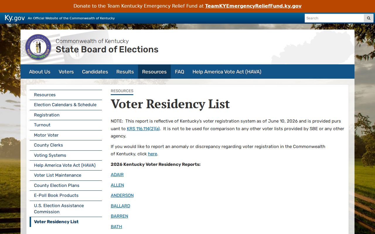
This screen reinforces that election data is a dated state record channel, not a complete Jefferson County household list.
Which Jefferson County Portals Understand ZIP
ZIP support differs sharply by portal. LOJIC can query its ZIPCODE field and display polygons. Accela accepts ZIP alongside street number, direction, street name, type, unit, parcel, city, and state. The voter request can arrange a permitted file by ZIP. The free PVA screen does not ask for ZIP, and the Clerk deed portal is keyed to names, documents, dates, book and page, or reference numbers.
| Portal | ZIP behavior | Best confirming field |
|---|---|---|
| LOJIC | Polygon layer and ZIPCODE query | Parcel ID or LRSN |
| Accela | ZIP is one of several address filters | Record number or parcel number |
| SBE-84 output | Household ZIP labels and selected geography formats | Precinct and dated file scope |
| PVA free search | No ZIP field; search street, number, or parcel | Parcel ID and situs address |
| Clerk deeds | No countywide ZIP browse | Party, control number, book/page, legal description |
Four Address Layers in a Jefferson County ZIP Search
A parcel can carry a physical situs, an owner tax-mailing address, a legal description, and a postal ZIP. The situs locates the property. The mailing address tells where a tax notice goes and may be a post office box, entity address, or out-of-county address. The legal description ties the land to a lot, block, subdivision, or metes-and-bounds description. The ZIP routes mail.
Do not collapse these fields. A mailing address does not prove residence, and a ZIP does not prove parcel ownership. Preserve the parcel ID and legal description when crossing between PVA, LOJIC, deeds, and permits. That stable bridge matters when a corner lot has two public labels, a multi-unit property uses one tax parcel, or an old street number has changed.
A Jefferson County Border Case Shows Why ZIP Is Not Enough
In July 2026, the Jefferson County Clerk reported a review of voter registration and precinct assignments after a state review showed 99.595 percent assignment accuracy. An August notice concerned judicial guidance over 211 voters at 137 addresses near Willow Creek and the Jefferson-Oldham border. These are dated, specific notices, not evidence of a countywide failure.
The practical lesson is narrower: postal routing cannot decide an election district. Near a border, verify the standardized USPS address, then compare LOJIC geography and the current election record with the responsible office. Keep the lookup date because boundary and assignment data can be corrected.
Jefferson County ZIP Boundaries and City Limits Differ
A Louisville delivery label may sit on property associated with St. Matthews, Middletown, Anchorage, Shively, Jeffersontown, or another home-rule or taxing jurisdiction. Likewise, 400xx and 401xx pockets can fall within Jefferson County without carrying the familiar Louisville 402xx label. The ZIP code directory therefore narrows geography but never settles local government, tax, neighborhood, parcel, or precinct status.
- ZIP versus ZIP+4
- A ZIP is the five-digit delivery area; ZIP+4 adds a finer segment for a block, building, group, or delivery point.
- PO-box ZIP
- A code assigned mainly or solely to post office boxes rather than ordinary street delivery.
- Unique ZIP
- A code assigned to one high-volume organization or institution. No Jefferson County example was established in the research.
- Carrier route
- A postal delivery path inside a ZIP, not a city, parcel, precinct, or resident boundary.
Boundary check. Verify the USPS label, parcel jurisdiction, LOJIC neighborhood, and precinct separately before making any claim about a Jefferson County address.