
Jefferson County Address Eras
No one roll names every person linked to a Jefferson County address. The sound trail moves from the current parcel to recorded deeds, then adds sources that describe occupants rather than owners. Each source has its own span and proof value. Keep the exact address, date, custodian, and whether the result is an index, image, or original file.
| Source | Time span | Keeper | Address evidence |
|---|---|---|---|
| PVA and LOJIC | Current | Jefferson PVA and LOJIC | Situs, parcel ID, owner, legal and map context |
| Clerk deed index | Index from 1984; images generally from 1992 | Jefferson County Clerk | Parties, instrument, date, book/page and references |
| Louisville directories | City from 1832; suburban from 1957 | LFPL, Metro Archives, Filson, KHS | Names, address, spouse, trade and occupancy marks |
| Federal census | Public schedules through 1950 | LFPL and federal archives | Household, relations, ages and owner or renter status |
| Accela cases | Planning from 2007; older docket route | Louisville Metro | Address, parcel, case type, status and public files |
A deed proves a land transfer, not residence. A directory or census may place an occupant there. The tax mailing address can belong to an owner, agent, or trust elsewhere. Previous residents should be named only when a dated occupant source supports that link.
Anchor a Jefferson County House
Start at the Jefferson County PVA Property Search. The free Address tab accepts a street number and street, a street-only query, or a number range. Basic results can show the owner, parcel ID, assessed value, acreage, and neighborhood. LOJIC adds parcel shape and map context. Copy the parcel ID, LRSN if shown, block, lot, sublot, and exact situs address.
Stable parcel fields bridge changes that a name search cannot. LOJIC data also includes recent deed book, page, and date fields. Those can lead straight to the Clerk index. The owner mailing address is tax correspondence and may differ from the physical house. It is not proof of occupancy.
Walk Jefferson County Deeds Backward
The Clerk grantor and grantee search leads from a current owner to earlier owners. Search the current owner as Grantee-Buyer near the purchase date. Record the seller, control number, instrument type, recording date, book and page, legal description, and any prior deed or plat cited.
- Copy the current owner, parcel ID, and legal description from PVA or LOJIC.
- Find that owner's purchase deed as Grantee-Buyer.
- Copy the seller's exact name, then search the seller as an earlier grantee.
- Repeat while matching lot, block, plat, and legal-description text.
- Continue at the Deed Room books or microfilm when online coverage ends.
- Grantor and grantee
- The grantor transfers an interest; the grantee receives it.
- Chain of title
- The linked sequence of transfers for the same land interest.
- Legal description
- Lot, block, subdivision, or boundary text that survives a street-label change.
Jefferson County's Digital Cutoffs
The deed index begins August 15, 1984, while images generally begin June 1, 1992. An index may identify a transfer even when its image is not online. Older title work moves to the Deed Room, books, microfilm, Metro Archives, or the Kentucky Department for Libraries and Archives inventory.
Search entities, estates, trusts, spouses, and spelling variants when the chain stops. An affidavit of descent, will, power of attorney, plat, or release may explain a transfer that does not look like a sale. The index and image cutoffs are a Jefferson County access quirk, not proof that an earlier deed is gone.
Louisville's 1909 Address Shift
Louisville changed street numbers in 1909. A directory, Sanborn map, census page, deed, and parcel card may describe one structure with different numbers. Preserve the old spelling and number. Then use ward, nearby names, lot and block, and legal description to bridge the change.
The Filson house-research method shows why adjacent years matter. Its local sample follows spelling and address changes across directories, death records, deeds, and the census. This is the right model for asking who lived here before.
Jefferson County Permits Date Change
Permits can mark construction, an addition, or a later change that explains a break in the address trail. Louisville Metro's Accela public search supports address and parcel research. Its planning guide covers cases from 2007 and points older work to a docket route.
The public search shown below may place a case party at a property date, but it is not a roster of previous residents.
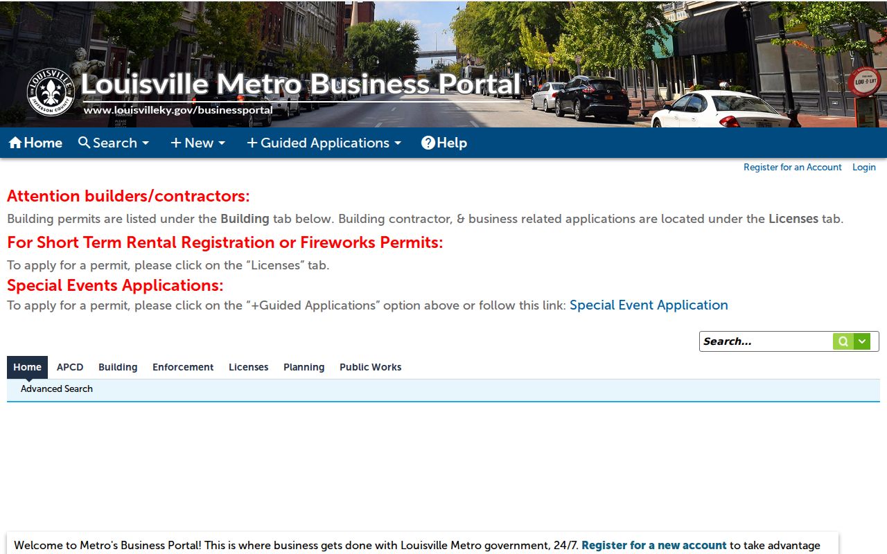
Record the case number, type, status, parcel, and public attachments. Then use a directory or census to test occupancy.
Jefferson County House Research Desks
When the web trail thins, route the question by source. LFPL offers directories, census schedules through 1950, cemetery books, newspapers, an obituary index, and Sanborn maps. Ask a Librarian remains useful while the main Kentucky History Room is affected by renovation. Metro Archives holds directory and government microfilm. Filson adds manuscripts, deeds, tax, probate, newspaper, and family collections.
Filson recommends appointments and opens Monday through Friday from 9:00 a.m. to 4:30 p.m., with no pull after 4:00 and closure on the third Friday. Record the call number, roll, and year requested. A catalog hit says a collection exists. It does not mean each page is online.
Pair Jefferson County Household Years
Printed directories supply yearly snapshots between census dates. Louisville's first run dates to 1832, LFPL describes city coverage to the present, and suburban coverage starts in 1957. The collections belong on the Jefferson County city directory page. For one house, extract only what connects that address through time.
Copy every name at the address in one year, then inspect the prior and next years. Note spouse, widow, trade, and house or renter marks. Test the group in the 1900, 1910, 1920, 1930, 1940, or 1950 census. Under the federal 72-year rule, 1950 is the newest public individual schedule.
- Transcribe the year, printed address, all names, and abbreviation marks.
- Check nearby years for moves, spelling shifts, or a new householder.
- Pair the nearest public census and compare relations, ages, and occupancy.
- Confirm a death or departure through obituary, cemetery, probate, or deed evidence.
LFPL's obituary index spans 1918 through 1987. Newspapers, Metro cemetery sources, probate, and wills can close a trail. Each is a dated clue, not proof of a living person's present address.
Lawful use. Research past residents for house history, family history, or personal curiosity. Never use a dated address trail to track, harass, or intimidate a living person.
What Jefferson County Records Prove
PVA and deeds name owners. Directories and censuses can name occupants. A permit names a public case party. An obituary or probate file ties a person to death or estate events. None should silently become a complete list of previous residents.
The soundest match has two independent anchors: address plus spouse, parcel plus deed date, or directory entry plus census or obituary. Keep original spelling, date, and repository citation. When evidence conflicts, report both forms until an image, legal description, or staff-assisted record resolves it.
Jefferson Records Beyond Directories
Older Louisville households often need a source outside the printed city directory. Tax lists can place a landholder when no directory entry fits. Probate papers may identify heirs, relatives, property, and an estate address. Marriage records can explain a surname change, while cemetery and obituary sources can show why a name disappears. The LFPL genealogy resources connect newspapers, obituary tools, cemetery material, census sources, and Sanborn fire-insurance maps. Sanborn sheets describe structures and lots, not residents, but they can verify that a building existed in the year studied.
Louisville Metro's five public cemeteries have uneven record histories. Western Cemetery dates to 1830 and has few surviving records, while Portland, Manslick, River Valley, and Meadow View represent later eras. A cemetery index is a trail endpoint, not proof that the deceased occupied the house. Pair it with a directory, death index, obituary, probate file, or deed transfer.
The archive landscape is changing. A May 2026 Clerk announcement describes tens of thousands of historic records found in the office and a Filson preservation partnership. Early examples concern free Black Louisvillians and Black congregations. The long-term aim is broader access, but catalogue status should be checked before citing the project as an available collection.
For gaps around a courthouse move or fire, inspect the series inventory. KDLA lists Jefferson County building-disaster dates, while another historical notebook reports no records disaster. Neither statement alone proves that a deed, tax book, or probate series was destroyed. Ask the Deed Room, Metro Archives, KDLA, LFPL, and Filson about the precise series and year. A missing web result and a missing historical record are not the same finding.
Early Jefferson Land Clues
Early tax lists can bridge the period before stable street addresses. They may identify a taxpayer, acreage, watercourse, neighboring owner, or taxable property. Surveyor entry books and land entries add another pre-address path. Move forward from the legal land description into deeds and plats, then connect the parcel to the later city directory number. This avoids forcing a modern address into a record created before that address existed and keeps the previous residents trail tied to recorded land.