
Walk a Jefferson County Street
A sound street search moves from place to person, then back to the source document. The free Jefferson County PVA Property Search accepts an address or Parcel ID and returns the basic parcel card. LOJIC supplies the map context. The Clerk index then connects the named owner to recorded instruments. Voter data and old directories can add evidence of residency, but neither should be treated as a live household list.
- Enter the house number and street in PVA. Save the Parcel ID, owner name, legal description, and assessed-value details shown on the card.
- Open the address in LOJIC Online. Click nearby parcels to check the street sequence and corner-lot geometry.
- Use the owner name in the Clerk's grantor and grantee index. Match the parcel or legal description, not just a familiar name.
- For a lawful voter-file inquiry, follow the state request process. The public self-check form is only for a voter checking their own registration.
- For an earlier household, move to the criss-cross and city directories held by local libraries and archives.
This Jefferson County street directory workflow distinguishes ownership from occupancy at every step. A current deed proves a recorded transfer. A parcel card identifies the tax-roll owner. A dated directory entry shows what a publisher printed for that year. Always save the source date with each address result. Combining two independent records is much safer than drawing a household conclusion from one screen.
Jefferson County PVA Street Fields
PVA's free tools favor place-based searching. That makes them a good first stop for a street directory even though the owner, legal, and sales tabs require a subscription. Subscription access is available without charge at the PVA office and Louisville libraries. Street-only or range searches can reveal several parcels on one road, while a precise number narrows the result.
| Search tab | Key fields | Public access |
|---|---|---|
| Address | Street number, direction, street name, suffix, unit | Free |
| Parcel ID | Parcel identifier | Free |
| Owner | Owner name | Subscription or library/office access |
| Legal | Subdivision, block, lot, legal text | Subscription or library/office access |
| Sales | Sale date, price, deed reference | Subscription or library/office access |
The returned parcel card may show an owner, property address, parcel number, property class, neighborhood, acreage, values, and deed references. It does not expose every mailing-address or assessment-history field on the free view.
See the inspected PVA parcel-card example before comparing the layout with the image below.
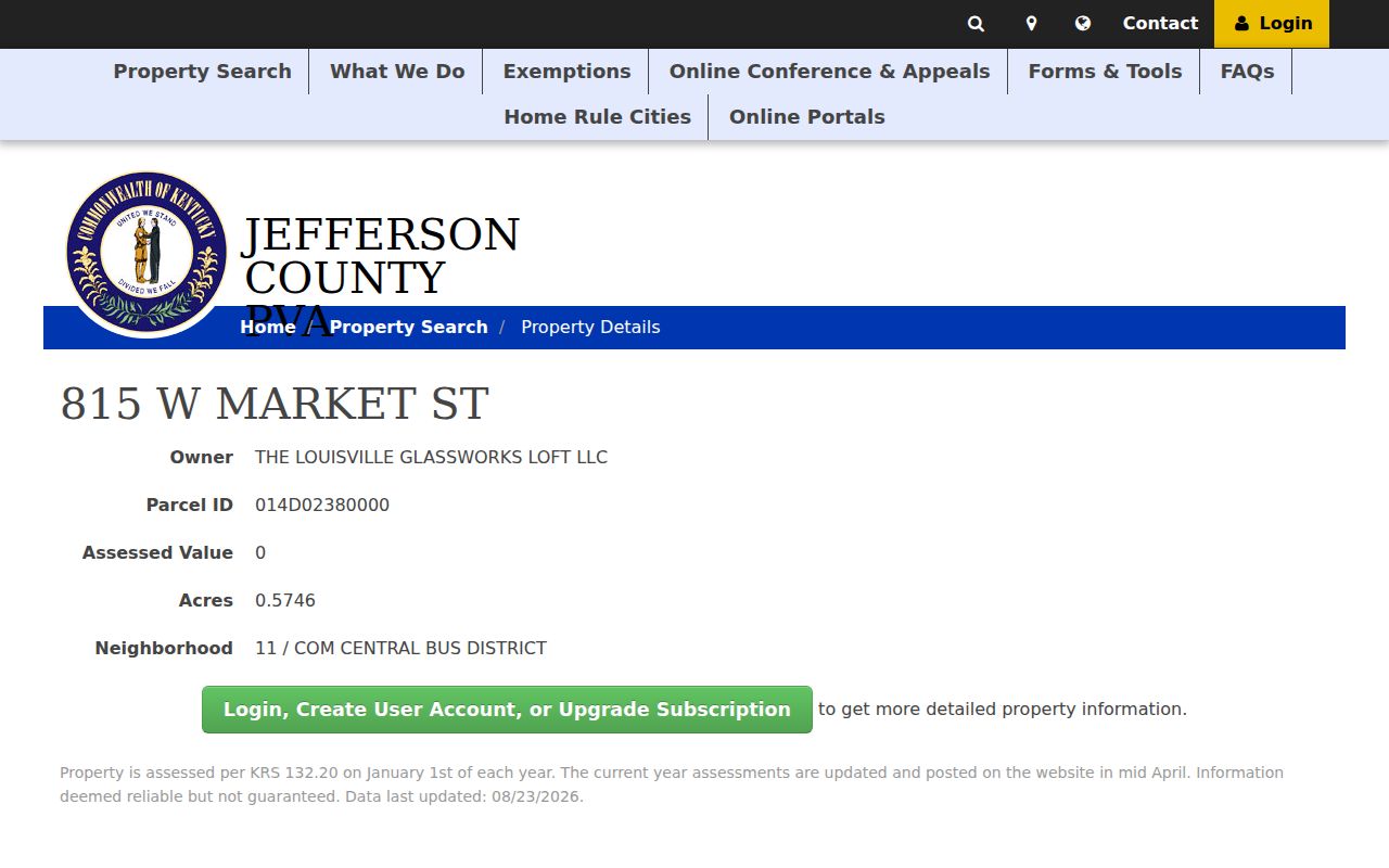
The card shows why a street search should capture the parcel identifier before moving into maps, permits, or deeds.
Map Jefferson County Street Parcels
LOJIC Online is the Louisville and Jefferson County GIS viewer. Its Find Address tool, parcel layer, aerial imagery, neighborhood layer, ZIP layer, reports, measurement, buffer, and print tools turn one address into a block view. Click-adjacent browsing is useful when house numbers skip, a corner parcel fronts another street, or one structure has several unit labels.
The open parcel schema includes PARCELID, LRSN, BLOCK, LOT, SUBLOT, and deed-reminder fields for book, page, and date. Those are stable joins when the street label changes. LOJIC's layer service limits a response to 2,000 records, so a broad export should be narrowed by street, ZIP, neighborhood, parcel, or geometry.
Insider tip. Save both the situs address and Parcel ID; the map pin alone is too weak for a deed or permit match.
Jefferson Street Record Terms
Several short labels recur across the county's address systems. Reading them correctly prevents a postal address from being mistaken for a legal land description.
- Parcel
- A mapped tract used for assessment. One postal address can involve more than one parcel.
- Situs address
- The physical location assigned to the property, which may differ from the owner's mailing address.
- Plat
- A recorded map that lays out lots, blocks, streets, and easements.
- Criss-cross directory
- A directory arranged by street and house number rather than only by surname.
Jefferson County includes Louisville Metro and many separate taxing jurisdictions. A Louisville mailing line, LOJIC neighborhood, ZIP, voter precinct, and incorporated city can all describe different geographic layers for the same parcel.
Jefferson County Street Record Coverage
No single roll answers who lives at every address. The useful sources differ by custodian, date, and access rule. This coverage table keeps the meaning of each hit clear.
| Record Set | Keeper | What It Shows | Access |
|---|---|---|---|
| Property roll | Jefferson County PVA | Tax owner, situs, parcel, value | Address and Parcel ID search free |
| GIS parcel map | LOJIC | Adjacent parcels, neighborhoods, ZIP, imagery | Free viewer and open data |
| Deeds and liens | Jefferson County Clerk | Recorded parties, transfers, plats, liens | Free index; counter, books, and copies |
| Voter data | Kentucky State Board of Elections | Regulated registration fields and street-order output | SBE-84 request, eligibility and use rules |
| Permits and cases | Louisville Metro | Permit, planning, code, address, parcel | Accela public search; older docket fallback |
The parcel number ties PVA and LOJIC to permit records. Deed book and page can then connect the parcel to the Clerk. Street spelling still matters for voter output and old directories. Keep each date and source with the name found.
Trace Jefferson Street Deed Chains
The Jefferson County Clerk land-record portal indexes records from August 15, 1984 forward. Images generally begin June 1, 1992. Start with the current owner's grantee deed, identify the seller, then search that seller as an earlier buyer. Book, page, control number, and legal description are safer links than a street address alone.
Name search offers grantor-seller, grantee-buyer, or both; pure-alpha or exact matching; first, middle, and last name; date range; instrument type; and report group. If a result is absent, loosen the date and instrument filters, try both party roles, and use a related-reference or book/page search.
Open the Clerk's book-and-page search to see the direct reference route pictured here.
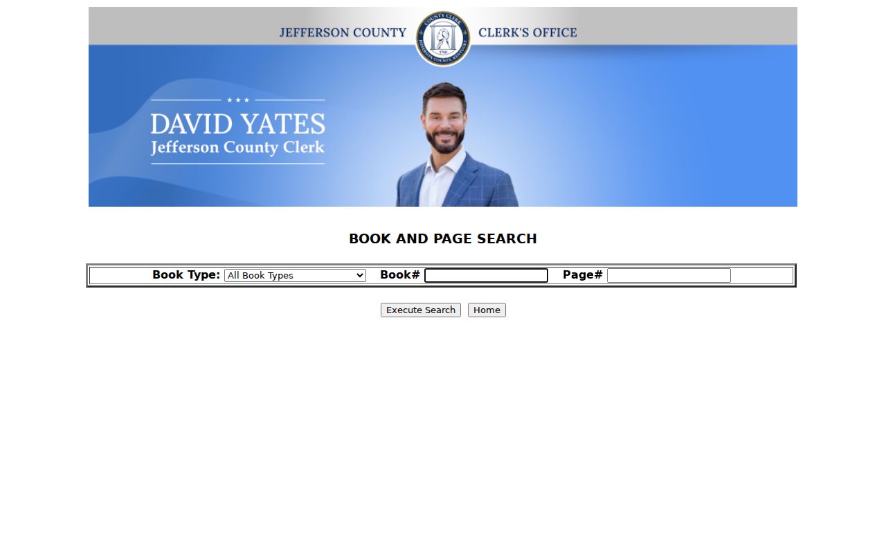
The simple form is most useful after PVA or LOJIC has supplied a deed reference; it is not a street-name search by itself.
Jefferson Addresses in Accela
Louisville Metro's Accela portal searches building permits, planning cases, code matters, and licenses. Address, unit, parcel, record number, and record-type tabs can link work or a public case to a site. Planning cases from 2007 forward use the online route; older cases need the documented pre-2007 docket method.
A permit proves that an application, review, inspection, or public case was tied to the address. It does not prove who occupied the building. Match its parcel, applicant, contractor, owner field, and date against PVA and recorded documents before joining names.
Note: Multi-unit buildings may have a base address, suite label, parcel address, and permit address that do not match character for character.
Jefferson Voters by Street
Kentucky's online voter information form lets a person verify their own registration. It is not a public street directory. County, precinct, or street-ordered voter data follows the separate SBE-84 request, with sworn eligibility and use statements, requested fields, format choices, payment, and delivery terms under state election rules.
A lawful file can contain registration fields useful for block research, but protected data is omitted. Social Security numbers, email addresses, and Safe at Home substitute-address details are not ordinary public search fields. A registration record also shows registration, not who was inside a home on a given day.
Jefferson's 1909 Number Change
Louisville changed street numbers in 1909. That event can break an address search even when the same structure and family remained in place. A directory, deed, census page, Sanborn map, and modern parcel card may use different number conventions. Preserve the old spelling and number before trying to normalize either one.
The best bridge combines adjoining household names, ward or neighborhood, lot and block, a plat, and a modern Parcel ID. Filson's house-research method treats renumbering as a key check, not a footnote. This Profile 2 insider issue is one reason a modern street directory cannot simply be searched backward year by year.
Note: A missing 1909-era address may reflect renumbering or a publication gap, not a move and not a destroyed record.
Historic Jefferson Street Occupants
Criss-cross directories reverse the usual name search. Start with the street section and house number, note the listed occupant, then turn to the alphabetical section for the fuller entry. Louisville Free Public Library, Metro Archives, Kentucky Historical Society, and Filson hold distinct parts of the city and suburban directory record.
Use the Jefferson County city directory collections for exact years, publishers, and shelf access. On the street page, the directory is evidence tied to one publication year. It can show a listed householder, spouse or widow notation, occupation, and residence mark, but it may omit many members of a household.
Jefferson Street Search Fallbacks
Online coverage has hard edges. For a deed older than the web index, contact the Jefferson County Clerk Deed Room at 527 W. Jefferson Street and use books or microfilm. Metro Archives holds city and suburban directories, municipal material, maps, land records, and more than 4,500 microfilm rolls. LFPL and KDLA add directories, county series, and reference help.
Under the Kentucky Open Records Act, an administrative record not already available may be requested from its custodian. The act does not turn a private or exempt record into a public one. State the address, date range, record type, and office likely to hold it.
The Deed Room route is essential for records before August 15, 1984 and for pages absent from the image system. Bring a present parcel lead, known party names, an estimated transfer period, and any book or page reference found in PVA or LOJIC. Regular copies are listed at $2 for the first three pages and $0.25 for each added page. Certified copies are listed at $5 for the first three pages and $0.50 for each added page. Check the Clerk's current fee page before ordering.
Metro Archives is a different custodian. Its public research room handles municipal series and the directory collection rather than the Clerk's current recorded-instrument index. KDLA can route older county and state archival series, while LFPL reference staff can help identify a directory year, newspaper item, census aid, cemetery book, or Sanborn sheet. Record the repository, collection title, roll or call number, year, and page for each result.
Limits of Jefferson Street Records
A PVA owner, deed party, voter entry, directory listing, or permit applicant does not prove who currently lives in a house. Renters and other household members may not appear. Utility customer data and ordinary driver-address data are not open household sources. Safe at Home can substitute an address in public records for eligible survivors.
The street directory is best used for property research, family history, civic questions, and the careful verification of a seller or recorded interest. Contact the person or the actual custodian when present occupancy matters. Never publish a guess about a private household as fact.
Lawful use. Jefferson County address records are for lawful personal research. Never use them to stalk, harass, intimidate, or harm anyone.